
My last column addressed how we writers of historical fiction see a modern setting and then imagine our way backward to how it might have looked at the time of our story and what events might have happened in that place. Now let’s focus on the place itself.
There’s no substitute for actually visiting the sites where your story takes place — absorbing the atmosphere of the location, getting a first-hand view of things that still survive from the time when your characters lived there. But when that’s not possible — or when the place has been bulldozed and replaced by high-rise condos or a shopping mall — we have other tools at our disposal.
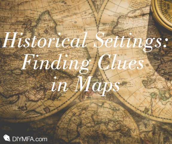
Think back to something Karen Brooks said in my interview with her earlier this year: “Don’t underestimate the importance of maps.” And not just Google Maps, though they do have a place. Try to find maps that are contemporaneous (or nearly so) with your narrative. There are all kinds of places to look. The internet, of course. Libraries, certainly. But don’t forget bookshops and antique stores.
A Treasure of a Map
Several years ago, I was fortunate enough to stumble across some remarkable antique maps while poking around a book store that specialized in older editions. One of the more unique things I found was a ribbon map from 1698.

Unlike conventional maps that show a broad area in which you find and trace out your route, this one takes the route, breaks it into strips, and identifies landmarks along the way. It’s very clever in that the start and end points are on opposite corners so you can use it in either direction. If you’re starting from Cambridge and going to Coventry, you start at the bottom of the left-most strip and go to the top, then pick up at the bottom of the next strip and so on until you arrive in Coventry at the top of the right-most strip. To go from Coventry to Cambridge, reverse the process.

Here’s a close-up from a couple of the strips to show how the landmarks are illustrated. I’ve left the image fairly large so you can get an idea of the level of detail provided.
After leaving Cambridge, the traveler would pass through an area with common fields on both sides. At two miles, the road goes uphill with common fields and buildings on the left and barns on the right. At three miles, there are hedges on both sides. About mile six, you’d come to a crossroads, but since the side roads don’t figure in your journey, the map maker treats them only as a landmark and truncates them on either side of your route. You know when you’ve left one county and entered the adjacent one by the shire names on the sides of the strips. And the compass roses provide an indication of the direction of travel.
What’s fascinating to me about this map is the sense it provides of what was useful and important to a traveler at the time the map was created. To an author, it’s a treasure trove of details that are available to lend realism to a character’s journey and put the reader into the character’s world.
Finding your own treasure troves
Maps from the time and place of your story are rich sources of information about the setting and are worth seeking out. In some places — particularly very old cities — the narrow lanes of old may still exist as modern streets, in some cases even retaining the street names that tell us what kinds of merchants or tradesmen conducted their business in that area. Battlefield maps are a great resource if your character is caught up in a war. In the countryside, many of the small tracks of yesteryear may have disappeared, especially when what was once countryside has succumbed to the encroachment of suburbs. But country roads may also be today’s minor highways.
And that’s where modern maps come in. Especially if you have the opportunity to visit your setting, being able to compare the modern map to the earlier one gives you the insight necessary to know where to look for the remnants of your character’s world. Current topographical maps — or even good current travel maps — can complement older, flat maps that have no indication of the terrain.
If your era is extremely old, your location is particularly remote, or your characters are nomadic, maps may be less practical as a tool for realistic world-building. But whenever you can get your hands on them, you’re certain to find something useful to bring the location of your story to life.

Pamela Taylor’s inspiration for her first book turned out to be that final straw that pushed her to leave the corporate world behind for the world of words and imagination. Now an author and an editor, she loves helping others polish their stories almost as much as she enjoys writing her own. She’s a member of the DFW Writers Workshop and the Editorial Freelancers Association and is in her third year on the judges panel for the Ink & Insights Contest. You can learn more about her books at secondsonchronicles.com, and about her editing services at editing4you.com.


